
Walk a Lewisville Street Directory
An address is the useful starting key, not a promise about a person. Enter the street number and name in the Denton Central Appraisal District, or DCAD, tools. Confirm the situs, which is the property location used by the appraisal record, then keep the PID or R number and legal description. Those stable parcel details carry the search to a deed even when an old street form differs. The owner or filing name in a CAD record is an appraisal lead, not proof of who occupies a property.
- Search the address in the DCAD property search and confirm the situs city and ZIP.
- Open the DCAD GIS parcel view, retain the PID or R number, legal description, subdivision, block, lot, and recorded deed metadata.
- Use the party name, document number, subdivision, or bounded date in the Denton County Clerk index to trace the instrument chain backward.
- For an election-history question, request a defined public list through the Texas Secretary of State rather than treating a lookup as a street roster. Protected addresses and identifiers remain withheld.
- When the question turns historical, compare a dated directory or newspaper item with the legal description, map, and deed rather than relying on one address line.
That sequence keeps source types separate. The Texas voter-list request form governs a defined list under Election Code Chapter 18, while a parcel or recorded instrument serves a property question. Lewisville historical directories and map materials are support for an earlier period, not a present-day resident roll.
Lewisville Street Directory Parcel Fields
The DCAD GIS and ArcGIS layer provide the most structured route from a Lewisville street address to a parcel. The layer separates the situs number, street, city, and ZIP rather than treating the mailing address as the property address. It also records public owner or filing information, parcel identifiers, legal land description, values, taxing districts, and deed metadata. These fields are useful because a historic street number can change while a block-and-lot description remains recognizable.
| DCAD or GIS field | How it helps a street search | Important limit |
|---|---|---|
| PID / geoID | Anchors the exact appraisal parcel or R number. | It identifies a parcel, not an occupant. |
| Situs number, street, city, ZIP | Checks the property-location form of the Lewisville address. | Keep it apart from mailing data. |
| Owner and mailing fields | Provides a public appraisal or filing lead. | Owner is not automatically a resident. |
| Legal description, subdivision, block, lot | Bridges street changes and connects the parcel to recorded instruments. | Copy it exactly for old-record searches. |
| Deed ID, volume, page, date, instrument | Points toward a document search in the Clerk index. | Confirm against the recorded instrument. |
| Land and improvement values | Describes an appraisal snapshot. | Values and owner data can change in appraisal cycles. |
The DCAD ArcGIS parcel layer shows the field structure used for this address work.
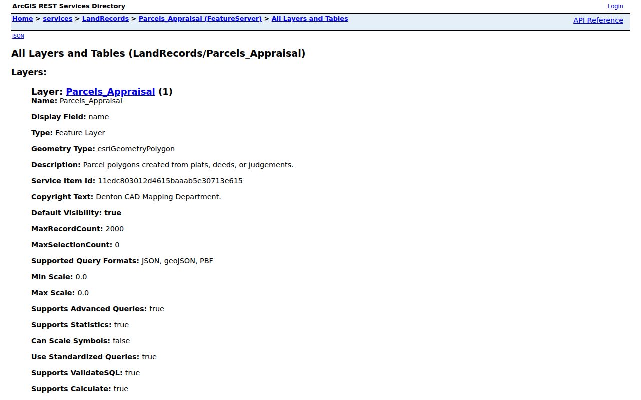
The layer supports a careful address-to-parcel check, but its geometry is informational rather than a legal survey. DCAD reports weekly geometry exports, while owner records can lag during annual appraisal processes and confidential ownership or over-65 exemption information is restricted in downloads.
Search Keys in the Lewisville Street Directory
DCAD, the county tax system, and the recorded-instrument index answer different address questions. Start the CAD search with the current street number and name. The county tax search can then test the account context, but its Owner Address field is a mailing address and its Property Location field is the situs. Its help examples direct users to enter a property location with the street number and name, omitting direction and street type. The visible tax interface has no ZIP filter.
| Official search | Fields or controls documented | Best use |
|---|---|---|
| DCAD property search / GIS | Address, property ID or R number, owner or filing lead, legal description, situs and map layers. | Stabilize the parcel and current property-location form. |
| Denton tax search | Account Number, Owner Name, Owner Address, Property Location. | Check the tax account while preserving mailing and situs values separately. |
| Denton official records | Quick Search term, recorded-date start and end, grantor or grantee, subdivision, document type or document number; index-only or index plus OCR. | Find a recorded transaction or set a date range. |
The Denton County tax search supplies the four tax-search paths.
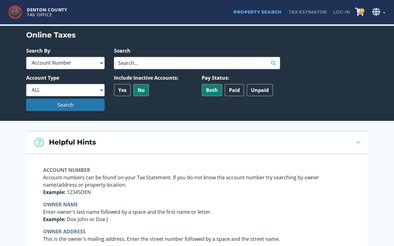
A tax result supplies account context, not a deed. If the property-location search does not resolve, return to the GIS parcel, normalize the street number and name, and carry the legal description forward.
Note: Preserve the query date and the exact address form because tax, CAD, and recorded records are updated on different schedules.
Lewisville Street Directory Records
Address-keyed sources can be combined only after their purpose is clear. The table below labels what each Lewisville resource can document. It avoids turning an ownership field, a dated directory line, or a civic record into a claim that someone presently lives at an address.
| Address record | Custodian | What it can show | Access channel |
|---|---|---|---|
| Current parcel and situs | DCAD | PID, legal description, public owner or filing fields, situs, values, map and deed metadata. | Property search, GIS, or ArcGIS layer. |
| Tax account | Denton Tax Assessor-Collector | Account, owner mailing address, and property location. | Online text search. |
| Recorded instrument | Denton County Clerk Recording Division | Deed, lien, plat, judgment, parties, date, and document type. | Official portal, counter, mail, electronic recording channels, or copy request. |
| Defined voter list | Texas Secretary of State | Permitted public election-list fields subject to statutory exceptions. | Notarized request and statutory process. |
| Historic address clue | Library, Portal, TSLAC, or Research Room | Directory line, newspaper notice, map, poll-tax context, or oral-history lead. | Digital scan, card-based database, microfilm, or appointment access. |
For a full recorded document, use the Denton official-records search first. The page offers Quick Search and Advanced Search, date controls, and index-only or OCR options. Its displayed certification marker is September 2, 2021, while the exact online beginning year was not located. When the needed image or older record is not available, request a specific copy from the Clerk or use the Denton County Research Room and TSLAC materials.
Lewisville Street Directory Geography
Street, postal, civic, and legal geography should stay in separate columns in a Lewisville street directory note. USPS can normalize a delivery address. DCAD provides the appraisal situs city and ZIP. The city residential-district map adds council-district context. A deed relies on the legal description. When any of those differ, retain the difference rather than forcing a single label.
- Parcel
- A defined piece of land used in the appraisal and mapping system. A PID or geoID helps identify it.
- Situs address
- The property-location address held in the appraisal record, distinct from an owner mailing address.
- Plat
- A recorded map or plan that can establish lot and block relationships in a subdivision.
- Criss-cross directory
- A reverse-form directory organized by address. No complete Lewisville run was confirmed, so it must be requested from the library rather than assumed online.
The DCAD GIS viewer is the entry point for checking the parcel and street layers together.
Use the map to find the parcel and public geographic fields. It does not settle a boundary, ownership, or occupancy dispute, and its parcel shapes are not a legal survey.
Lewisville Street Directory Deed Checks
Once DCAD gives the legal description and current deed metadata, the recording search turns a street lead into a document trail. Search the current grantee or grantor, document number, subdivision, document type, or a narrow recorded-date range. Read the recorded instrument before deciding what a party relationship means. A grantee may not have occupied the property, and a recorded lien or plat has a different meaning from a deed.
The Recording Division maintains real-property instruments at 1450 E McKinney St in Denton, with counter, mail, and electronic-recording channels. If the online index is not enough, the Clerk copy form accepts a case or cause number when relevant, case name, document title, filing date, copy type, and delivery preference. The form permits six document rows and excludes sealed documents unless legally permitted. A specific request is more useful than a broad request for every record on a street.
Note: Record the instrument number, date, party names, legal description, source link, and whether the item is an index entry or a supplied copy.
Lewisville Street Directory Voter Limits
Election information has a narrow role in address research. The Denton County voter-lookup page was identified, but it returned a 403 during research, so its live fields, update time, and ZIP behavior were not verified. Texas public voter data is available in defined forms, but protected residence addresses and specified identifiers are withheld. Texas also does not register voters by party.
A requester who needs a lawful defined list should use the state process, retain the scope and date, and respect the statutory affidavit and access conditions. A list can assist civic-history or precinct research. It cannot prove that every person connected to a street is still there, and it should never be assembled into a household roster.
Lewisville Street Historic Forms
Older Lewisville address research needs more than a modern street query. Library city-directory holdings are confirmed, but the library does not publish a complete title-by-title year list, reverse-directory run, or standalone obituary index. The Portal to Texas History offers a concrete 1956 Dallas directory page with Lewisville-area rural-route and box entries. It is a Dallas directory, not a verified Lewisville-only run.
Inspect the scan rather than trusting OCR. The page uses h for home and r for room or residence notation, and a route or box line is a geographic lead rather than a modern address. The historical collections themselves are described in the Lewisville city directories. Pair a dated line with a deed, census, newspaper, oral history, or map before treating it as a household connection.
Lewisville Street Map Limits
Lewisville’s confirmed 1912 Sanborn sheet can orient an old block through building footprints, materials, doors and windows, water facilities, businesses, property boundaries, house or block numbers, and fire notes. It cannot name an occupant. TSLAC map records from 1961, 1970, 1972, 1973, 1983, 1988, 1991, and 1992 add later roads, schools, rail lines, cemeteries, subdivisions, and boundary context.
No official Lewisville street-renumbering or street-renaming schedule was located. A mismatch is therefore an unresolved historic-address issue, not evidence of a renumbering on a particular date. Compare road intersections, parcel geometry, legal description, older directory abbreviations, and alternate street forms. If the answer depends on a street change, request a plat, road, ordinance, or other custodian-held record through the City Secretary.
Lewisville Street Source Card
A useful street note records the address exactly as searched, the normalized postal form, the DCAD situs, PID or R number, legal description, and the retrieval date. Add the tax account only when it answers a tax question. For each deed, retain the instrument number, type, date, grantor, grantee, and whether the evidence is an index or a copy. For a historic directory or map, keep its year, page or sheet, publisher or custodian, and scan link.
This compact record card makes contradictions visible. An owner field may be current but delayed. A directory line may be dated but incomplete. A Sanborn sheet may explain a block without documenting a family. Independent agreement between a deed, an address-form record, and a dated historical source produces a stronger conclusion than any single search result.
Lewisville Street Research Gaps
Several limits are documented rather than guessed. The Clerk portal’s exact starting year was not located, despite its certification marker. The live voter page fields were not available during inspection. The library confirms historical directory holdings but not a complete year run or reverse directory. The city has no verified public schedule of street renumbering or renaming. A missing result can reflect one of these access gaps, an alternate address form, a protected record, or a record held only at a counter or archive.
The practical fallback is specific: use a Clerk copy request for an identified instrument, ask the library’s Adult Services Desk about a dated directory or microfilm title, make a Research Room appointment for early Denton County people-and-place material, and consult TSLAC microfilm for older deed, tax, poll-tax, and map records. Preserve the custodian and access method beside the result.
Lewisville Street Directory Privacy Limits
A Lewisville street directory can document a parcel, a transaction, a dated directory entry, or a carefully defined civic record. It cannot supply a complete current household list. Owner, grantee, directory, and voter references are not interchangeable with occupancy. Confidential ownership, protected voter addresses, and other restricted identifiers must remain protected. Use a source label and date every time a name appears.
Personal, lawful use. Use Lewisville address records for family history, property research, civic questions, or other lawful personal purposes. Do not use record details to stalk, harass, intimidate, or harm anyone.